
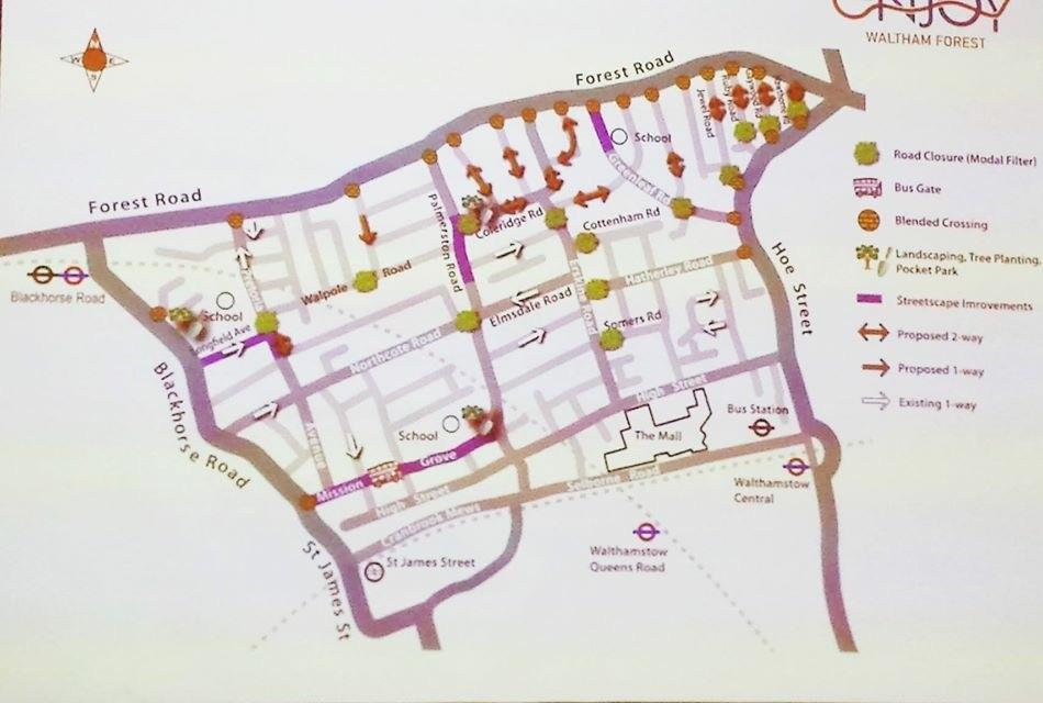
More proposed road closures have been revealed in a new map for the multi-million pound Mini Holland cycling scheme in Waltham Forest.
As the council consults on the £33million project to improve cyling safety, which has divided opinion in the community, further details have emerged of chages to traffic flow.
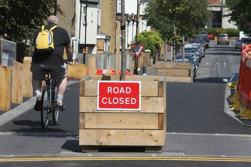
At present, work is being rolled out across the Walthamstow village area and is already improving the area, according to some residents.
However, a group of residents has launched a legal challenge in an attempt to force the council to re-apply for a road closure order after it emerged the consulation was not conducted properly.
There is also ongoing concern over traffic congestion and access to businesses.
A map released at a meeting on the project in central Walthamstow shows proposals for the Blackhorse Road area of the scheme.
According to the authority, a key feature of the plans is ‘villigisation’, with council figures showing only 35 per cent of residents in the area use a car.
In the designated ‘Blackhorse Village’ area there are over 4,700 residents and 490 commercial properties.
The map shows a number of suggested road blocks where cyclists will be allowed through, but not cars.
At present there is a proposed filter on Walpole Road with Wellington Road and on Pretoria Road close to the junction with Longfield Avenue.
The plans also a suggested road block for cars on Northcote Road close to Palmerston Road.
Wellington Road could be made one-way only.
A public consultation on the proposal is ongoing, with the final design due to be revealed by September.
In the Hoe Street area, possible closures for two-way traffic include Howard Road, Rectory Road and The Drive at the Church Hill junction.
In Leyton a full consultation will begin in October and end in November, although the council is currently in the ‘early engagement’ stage with residents.


Comments: Our rules
We want our comments to be a lively and valuable part of our community - a place where readers can debate and engage with the most important local issues. The ability to comment on our stories is a privilege, not a right, however, and that privilege may be withdrawn if it is abused or misused.
Please report any comments that break our rules.
Read the rules hereLast Updated:
Report this comment Cancel