
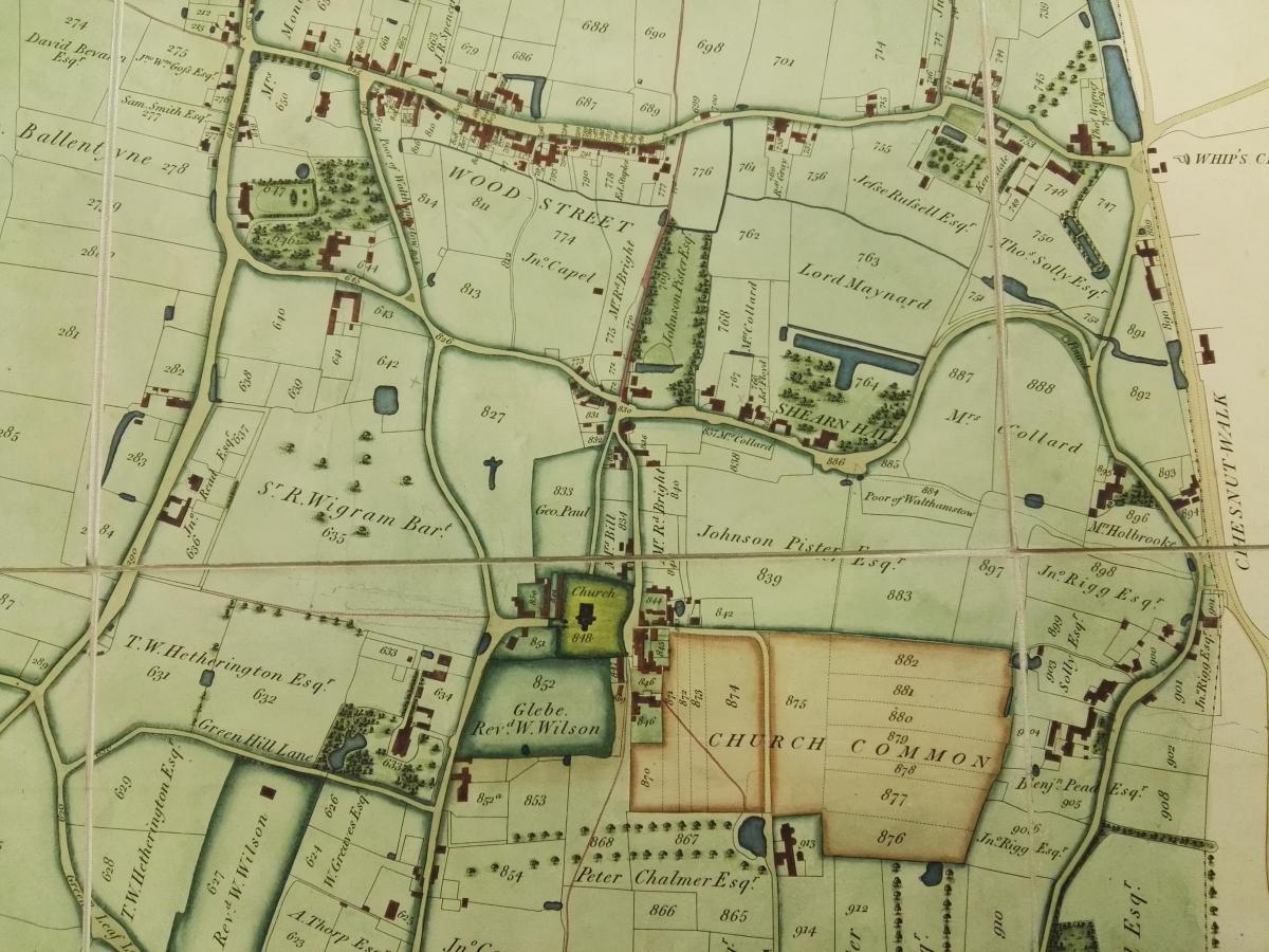
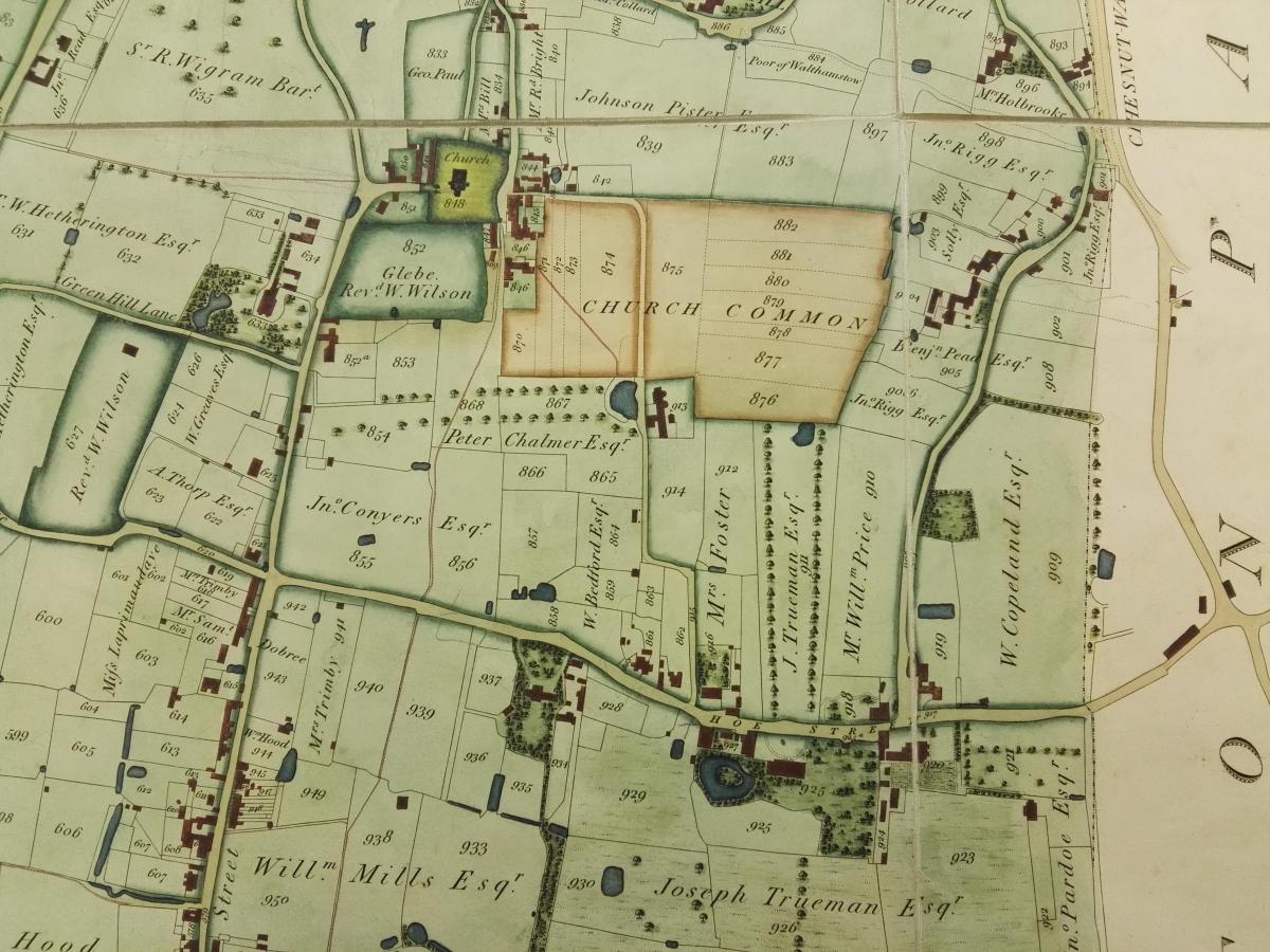
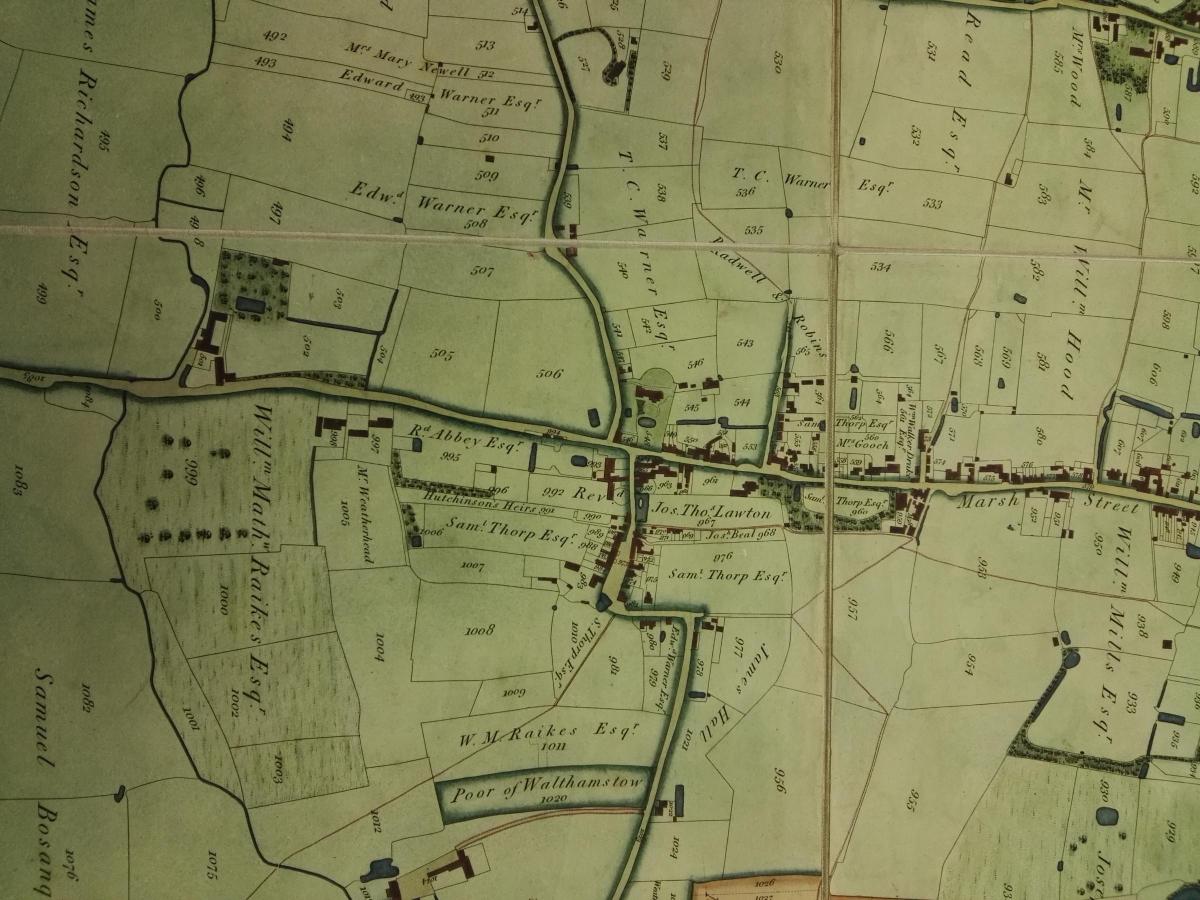
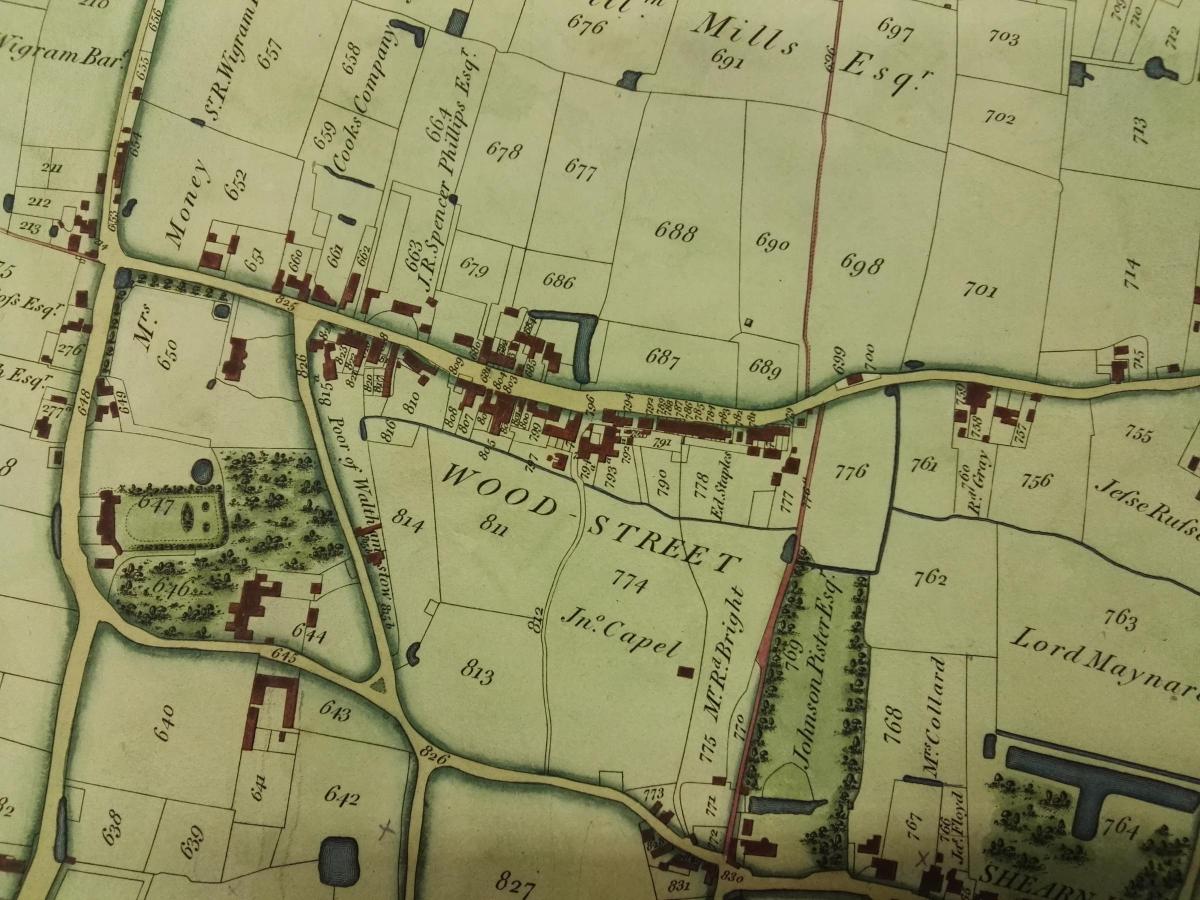
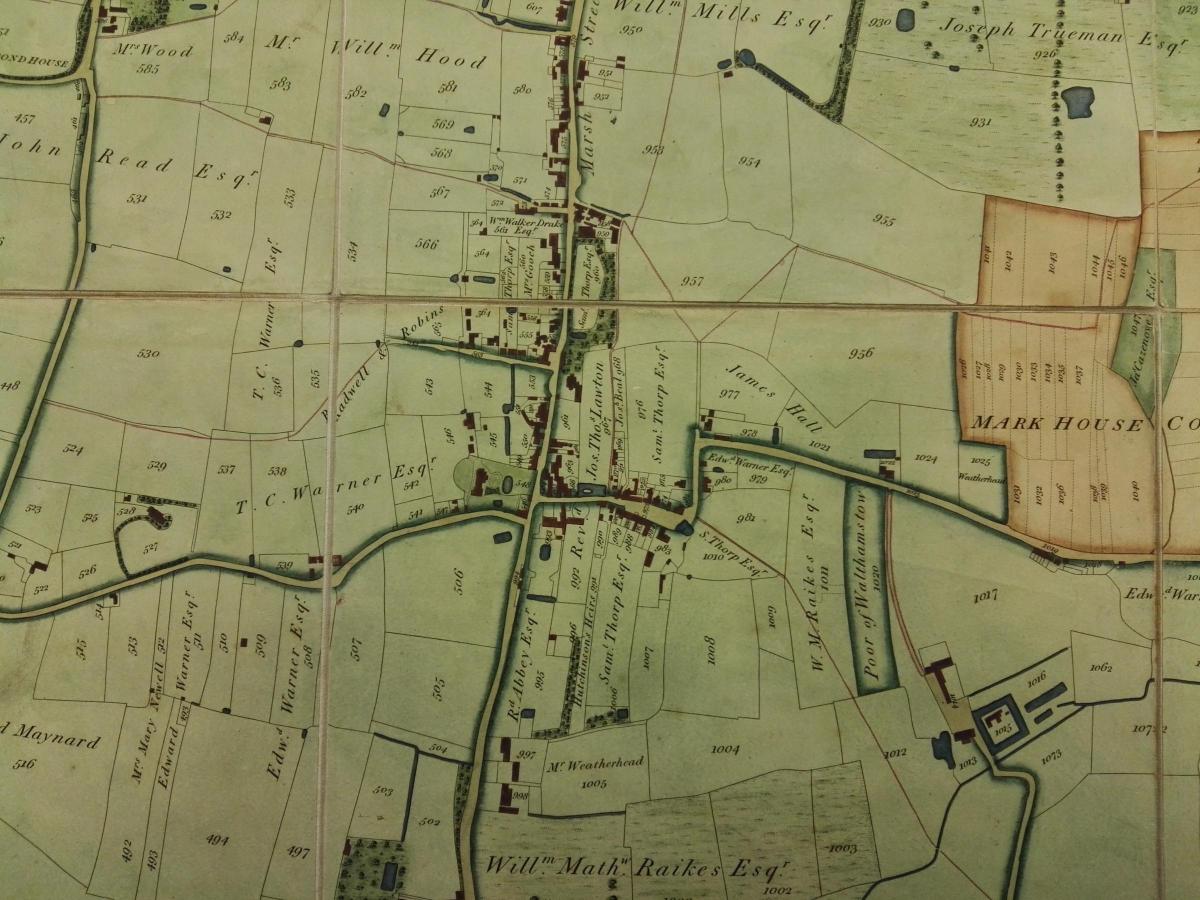
There is a fascinating and beautiful map within the Waltham Forest Archive collection at Vestry House Museum in Vestry Road, Walthamstow, which depicts Walthamstow as it was in 1822, in the early 19th Century, just a few decades before urban expansion took hold and the landscape was changed forever.
Produced by Vestry clerk John Coe, it plots the houses and extent of land plots in the parish at that time, and is annotated with the names of some of the main landowners.
At first glance it looks alien to the Walthamstow of today, but a closer look reveals familiar elements: modern-day streets can be seen in field patterns, and clusters of buildings can be seen along Wood Street, High Street (then Marsh Street) and Hoe Street.
Some of the landowners' names have survived as modern-day street names, and some of the mansions on the map still stand today.
Can you identify the location of your home, street, favourite pub or eaterie?
The original copy of this fabulous map (this is the digitised version) can be seen by appointment at Waltham Forest Archives. wfa.enquiries@walthamforest.gov.uk
Karen Averby is a seaside-loving historian and research consultant specialising in researching histories and stories of buildings, people and places. She researches house histories for private clients and collaborates in community heritage projects (karenaverby.co.uk). She is also director of Archangel Heritage Ltd, an historical research consultancy providing research services for the commercial heritage sector (archangelheritage.co.uk). Also found on Twitter @karenaverby and @archaheritage


Comments: Our rules
We want our comments to be a lively and valuable part of our community - a place where readers can debate and engage with the most important local issues. The ability to comment on our stories is a privilege, not a right, however, and that privilege may be withdrawn if it is abused or misused.
Please report any comments that break our rules.
Read the rules hereLast Updated:
Report this comment Cancel